This study was conducted from 2004-2007 and may no longer reflect current conditions as weather, management practices, and available data have evolved. This research remains valid, but should be considered alongside more recent findings.
Farms in southwest Wisconsin’s driftless region face a unique set of water quality challenges. The hilly, unglaciated landscape and shallow fractured bedrock create conditions very different from the rest of the state. To better understand how these farms affect water quality, Discovery Farms partnered with Heisner Family Dairy in Iowa County, Wisconsin to monitor water from 2004 to 2007.
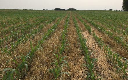
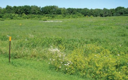
The Heisner farm is a certified organic, grass-based dairy operation with 110 dairy cows, 50 heifers, and 20 calves grazing 140 acres of rotationally managed pasture. The farm also manages 350 acres of organic cropland, using tillage, crop rotations, and cover crops for weed control instead of herbicides.
How the Study Worked
Researchers set up three monitoring sites to track where water, sediment, and nutrients were coming from and going. One edge-of-field site tracked runoff from a 15.8-acre organic cropland area. Two in-stream sites measured water quality upstream and downstream of the farmstead, covering 191 acres that included the milking facility, winter housing, and grazed pastures.
What the Data Showed
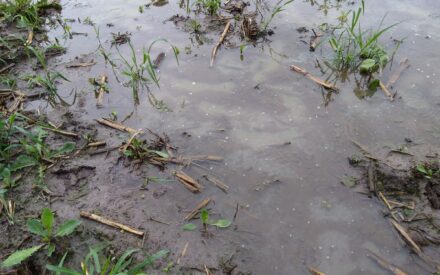
Frozen ground is when most losses happen. At the edge-of-field site, 99% of total surface runoff occurred when the ground was frozen. Most of this happened in February and March. Manure applied during frozen ground periods, combined with rain-on-snow events, drove the highest nutrient losses. The highest single-year phosphorus loss was nearly 2.5 lbs/acre, and the highest nitrogen loss was about 16 lbs/acre, both in 2005 when frozen-ground runoff was greatest.
Surface runoff during summer was surprisingly low. During non-frozen periods, almost no runoff was measured, even during intense summer rainfalls of 2.3 to 2.6 inches. The shallow, fractured dolomite limestone bedrock in this area likely allows water to infiltrate rapidly and travel underground, resurfacing as springs lower in the landscape. This is an important distinction from other Wisconsin farming regions.
Springs and base flow dominate stream water. About 80% of water contributed by the farmstead area came as base flow, mostly spring flow. Over the three-year study, the farmstead area (27% of basin acres) contributed 53% of total downstream flow volume. This makes it difficult to directly link individual management practices to stream water quality.
Cattle stream access affects water quality. Cows had access to the stream as a water source in several paddocks. Hoof traffic and manure near stream banks likely contributed to elevated sediment and phosphorus loading, especially during storm events. The two most downstream sampling sites approached or exceeded the USGS recommended limit of 0.1 mg/L total phosphorus for rivers and streams.
What the Farm Changed
During the study, the Heisners built hoop barns for winter housing, which moved cattle away from the stream corridor during winter and gave the farm more control over when and where manure was applied. This reduced the risk of manure running off during high-risk weather periods. The farm also continued to use cover crops and small grains to reduce soil erosion on cropland.
The Bottom Line for Wisconsin Farmers
If you farm in the driftless region, frozen ground is your highest-risk window for nutrient loss. Managing when and where you apply manure during late fall and winter can make a real difference. And if cattle have access to streams, restricting that access during high-risk periods is one of the most direct ways to protect water quality on your farm.
Explore This Study in More Detail
This resource is meant for print purposes, only.
Understanding Nutrient and Sediment Loss: Heisner Family Dairy Project (PDF) ↗️